| code | tms |
| project | resources, built and social fabrics as drivers of sustainable city-making |
| type | territorial research |
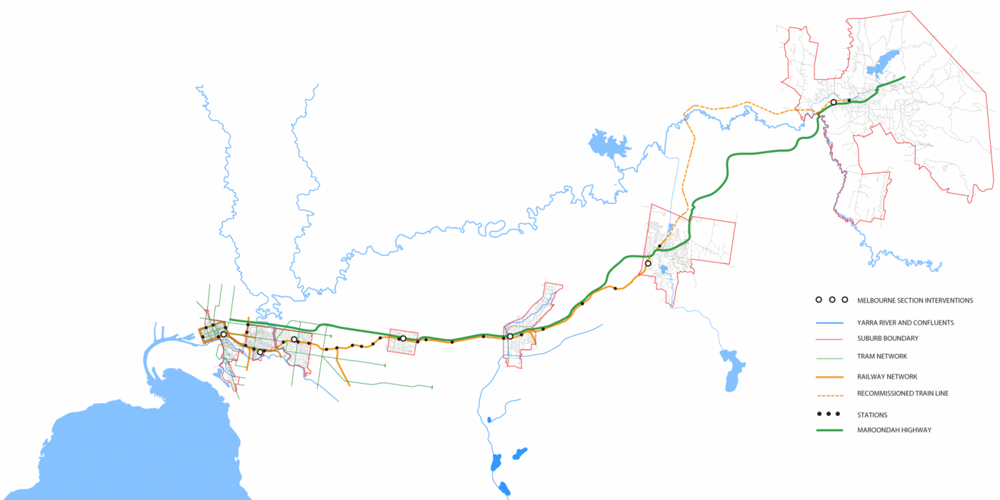
| size | 60 km urban transect |
| funding | 12,000 AUD |
| client | monash university |
| collaboration | milica topalovic & martin knuesel (Future Cities Laboratory) |
| location | victoria, aus |
| year | 2013/14 |
| status | complete |
The Melbourne Section is a collaborative urban research project led by Maud Cassaignau and Markus Jung from the Department of Architecture at Monash University, together with Ass. Professor Milica Topalovic and Martin Knüsel from the Future Cites Laboratory, Singapore-ETH-Centre (SEC).
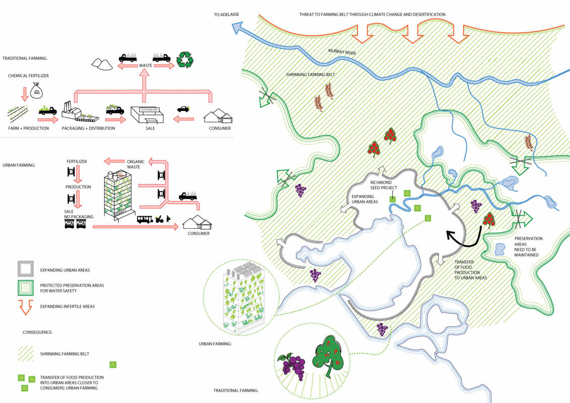
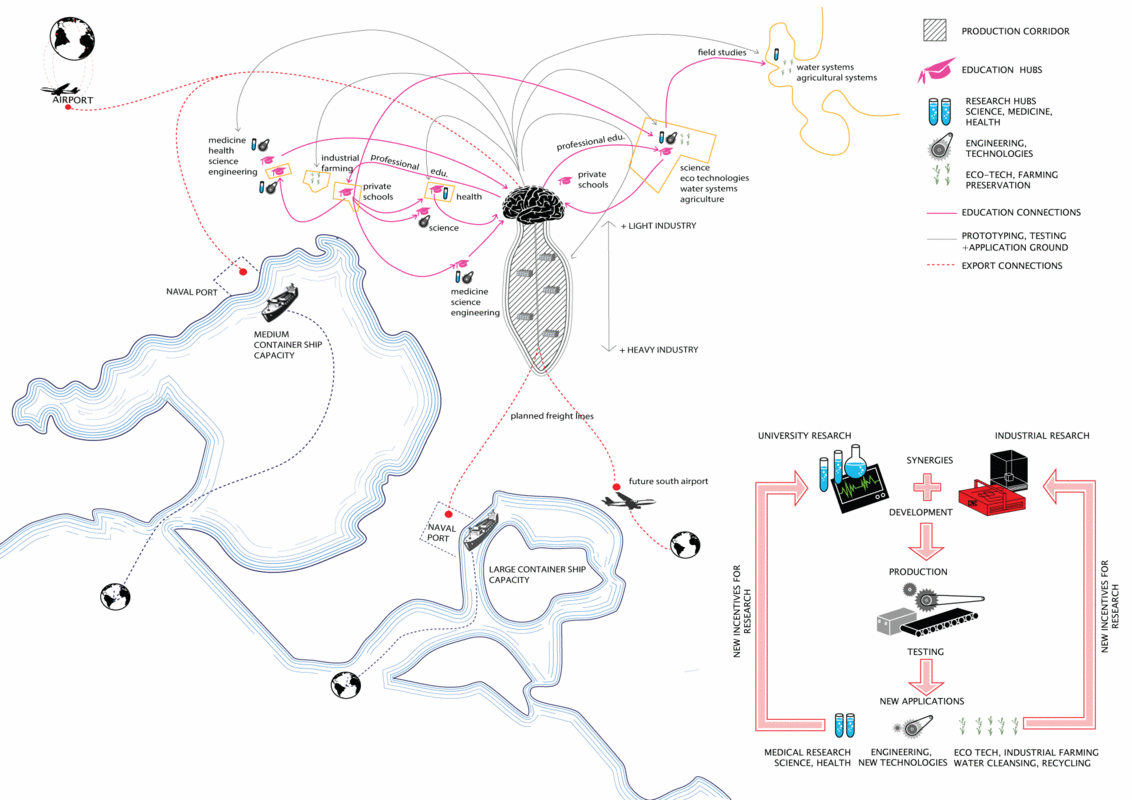
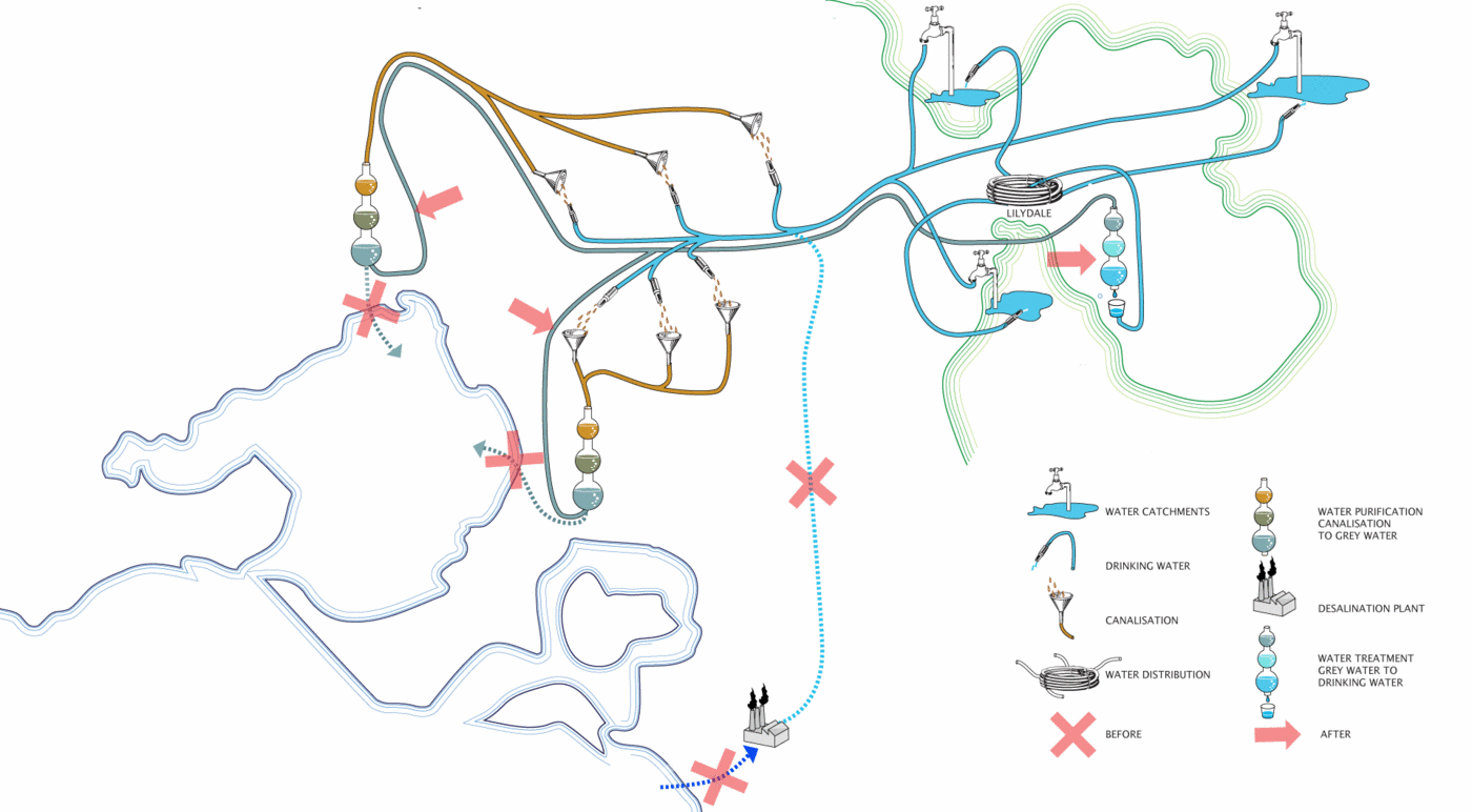
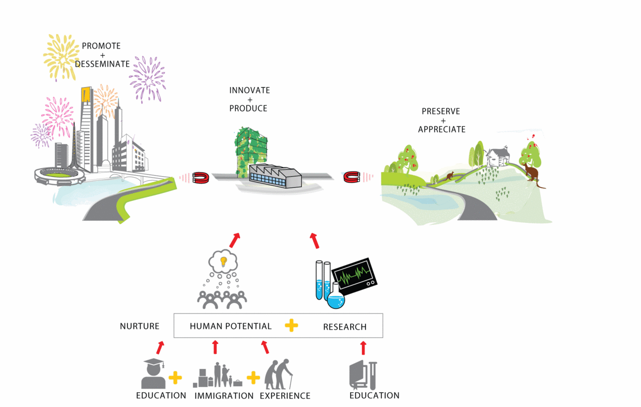
The Melbourne Section research investigates future scenarios for a sustainable growth across Melbourne’s territory. A section drawn through the different layers of the urban fabric, from the CBD to the peri-urban fringe, is used to develop a long term vision. It uses and develops existing assets of the urban fabric, such as identifying vectors for new economic growth, using immigration flows and education as drivers for innovation, implementing resilient resource networks for water and food production, and addressing issues of climate and environmental change. The Melbourne Section research attempts to press the urban and environmental problematics of such a fast growing city, which is expected to increase its population by 1.8 M by the year 2036(1).
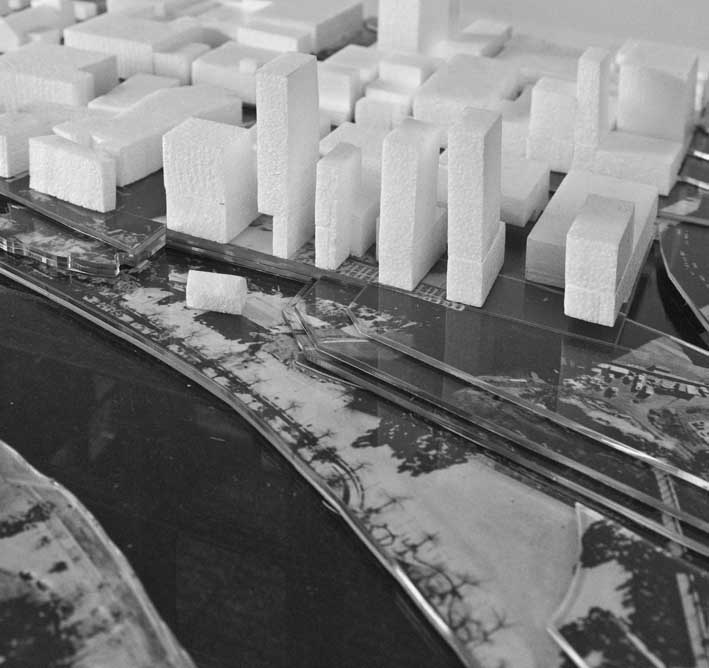
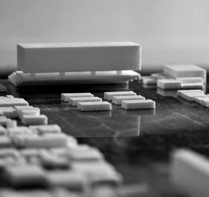
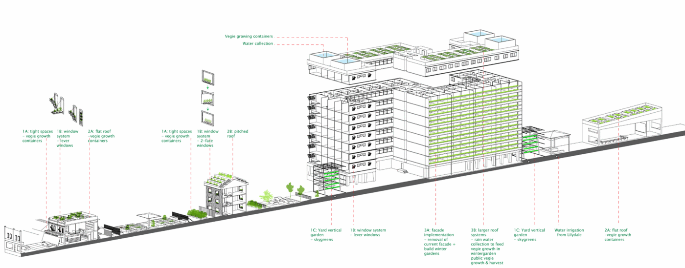
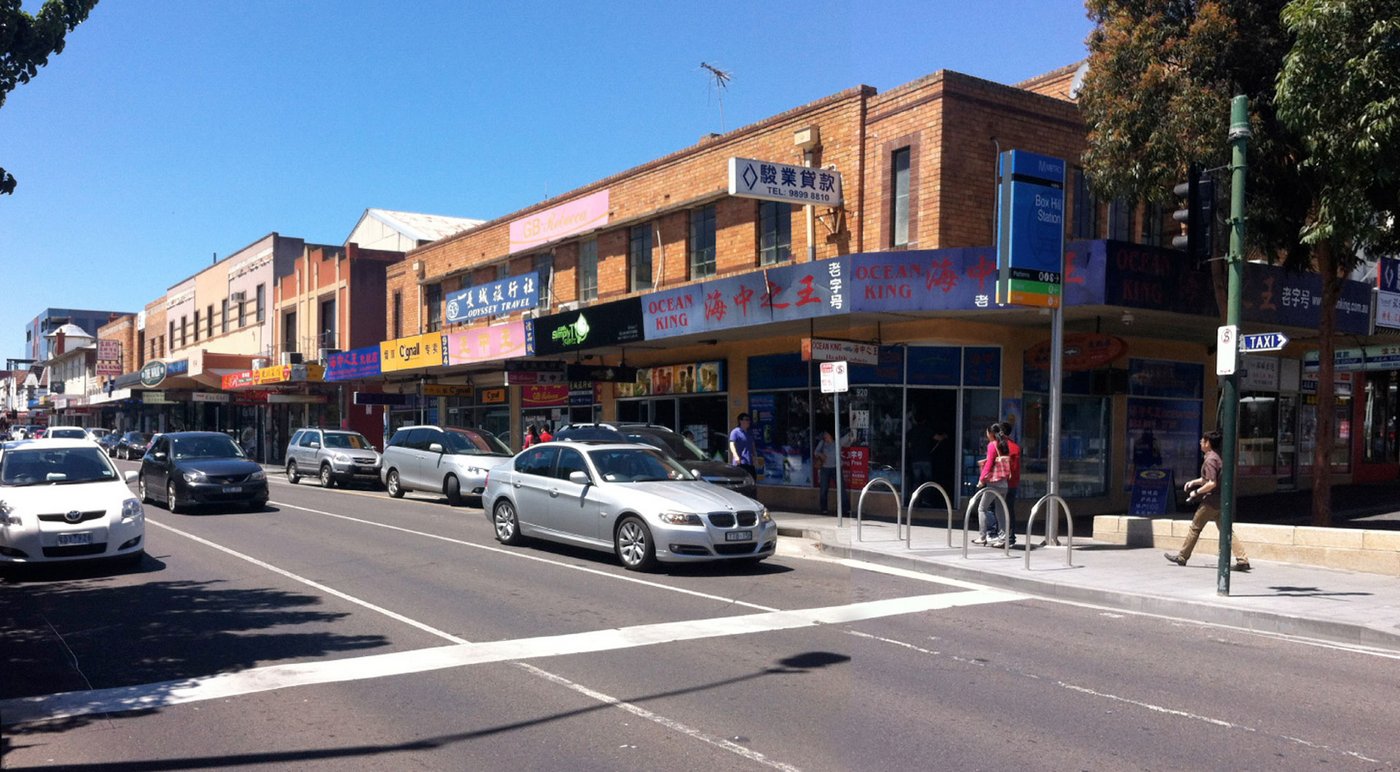
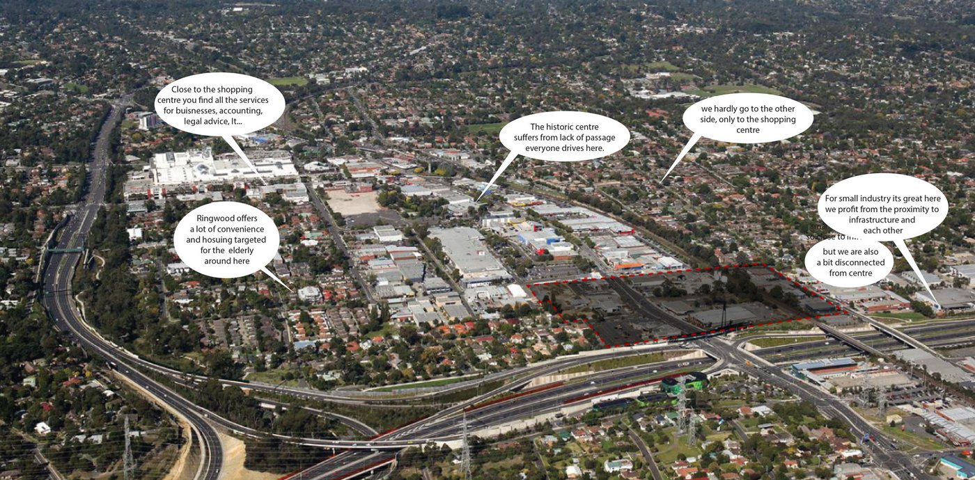
Nowadays the urban growth boundary of Melbourne covers an enormous territory of 385km2 with only 4.2 M inhabitants. This complex territory is structured in different rings of urban development, which are difficult to grasp and comprehend as one system. The scientific method of tomography acts as a metaphor for the Melbourne Section, where a section is applied onto a distinct territory scanning through the different urban settlement rings. This methodology produces an in depth and holistic understanding of the territory analysed and provides information about Melbourne’s greater urban form as well. The research findings form the base for the vision, harvesting existing qualities of the place. The particular section chosen follows one of the oldest development axes of the city along the Maroondah Highway. It hosts major employment and production centres(2), as well as vital resources such as the Melbourne water supply network.
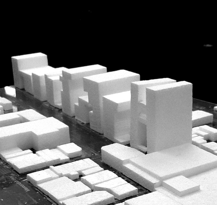
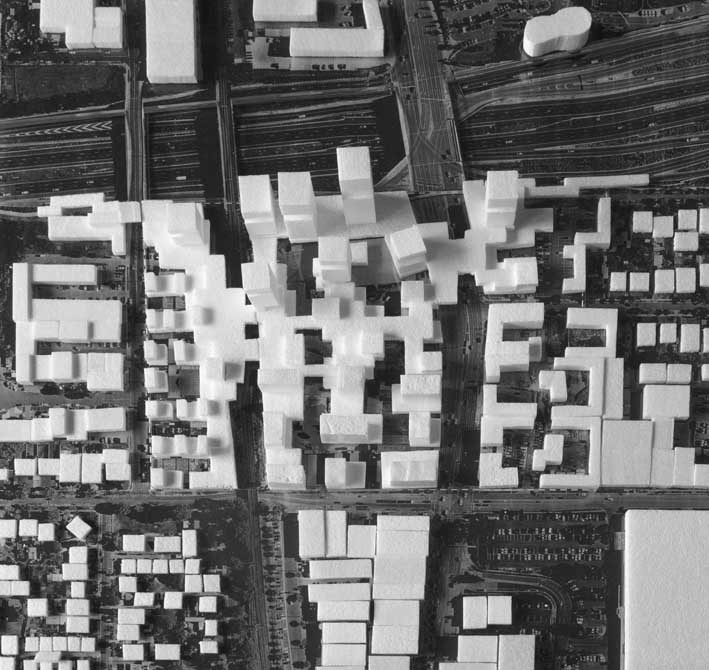
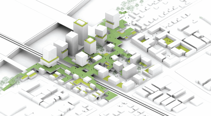
The densification and consolidation of existing areas is considered a key element of the strategy; building on strengths and potentials and establishing new synergies within the section, rather than further expanding into new areas and diluting infrastructures and efficiencies.
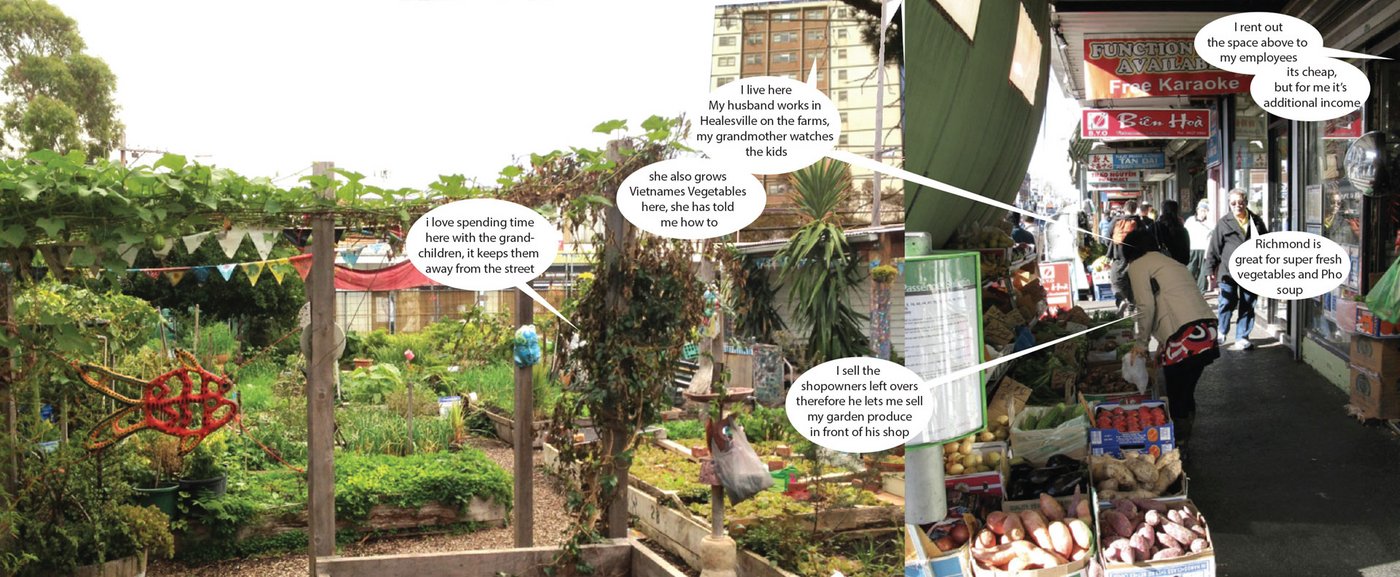
Urban analyses of Melbourne’s current urban conditions form the starting point of this speculation. Preliminary investigations allowed a picture to be drawn, highlighting how invisible factors have influenced settlement patterns in Melbourne’s recent history.
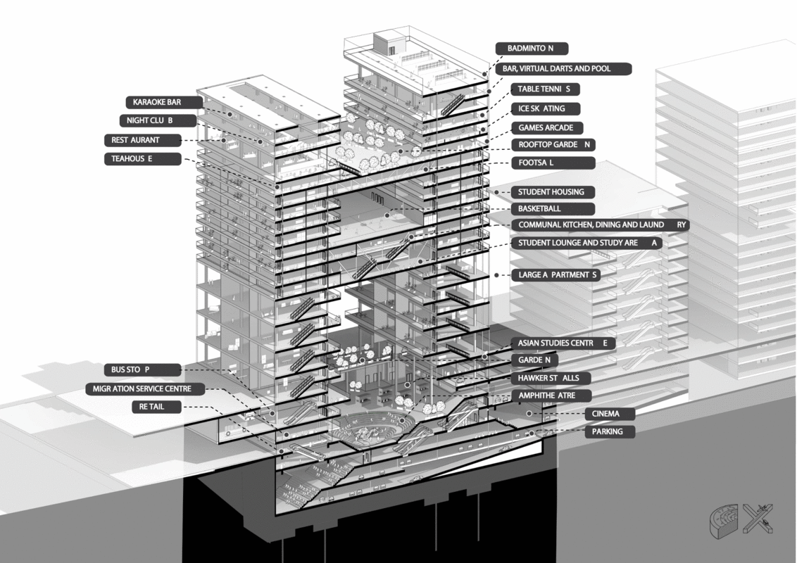
The research operates at different scales: from regional-metropolitan scale, via the local-urban context, to the site-specific architectural scale. The research reflects on the geostrategic location of Melbourne within the Asian-Pacific context(3) and its unique economy, demography, and geographic position. The research also builds on developing existing and future potentials. The objective is to reinforce and complement found qualities, potentials, and synergies.
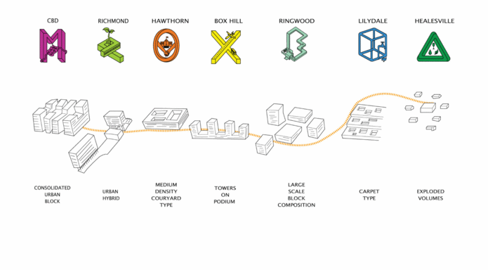
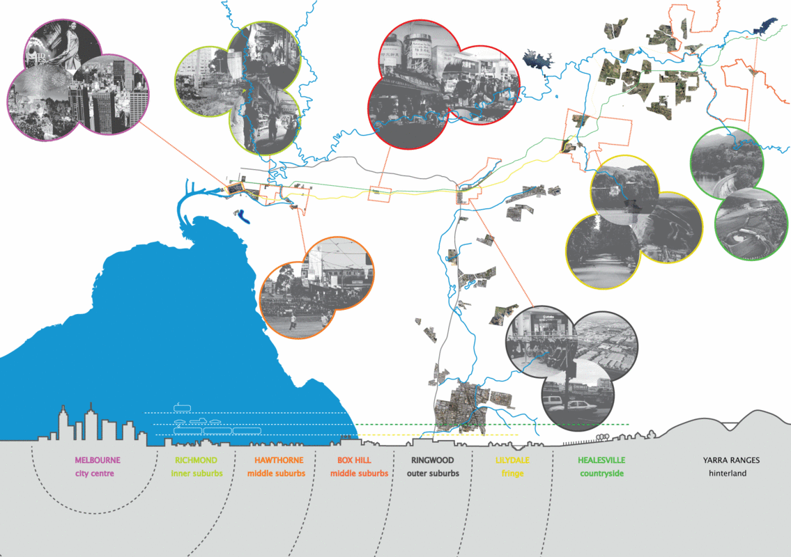
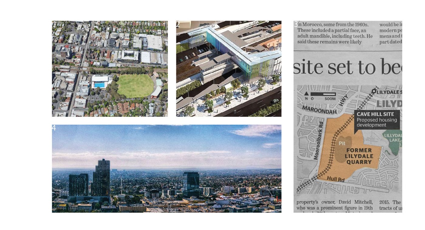
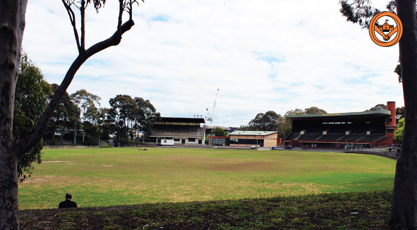
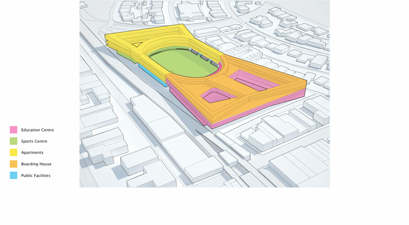
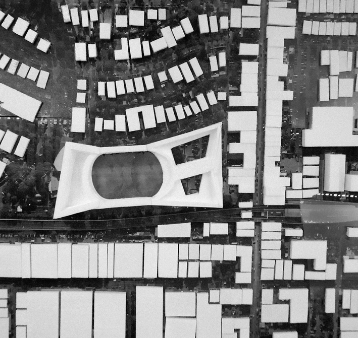
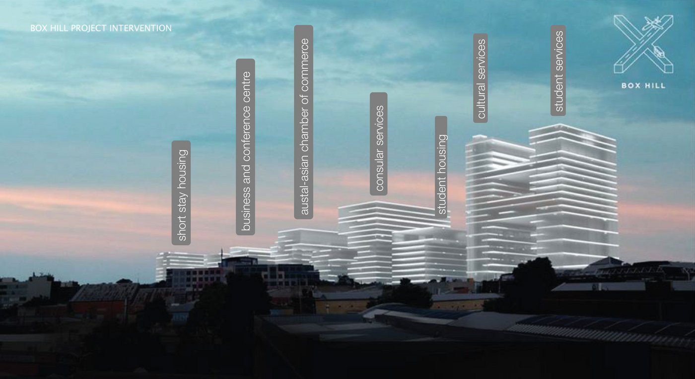
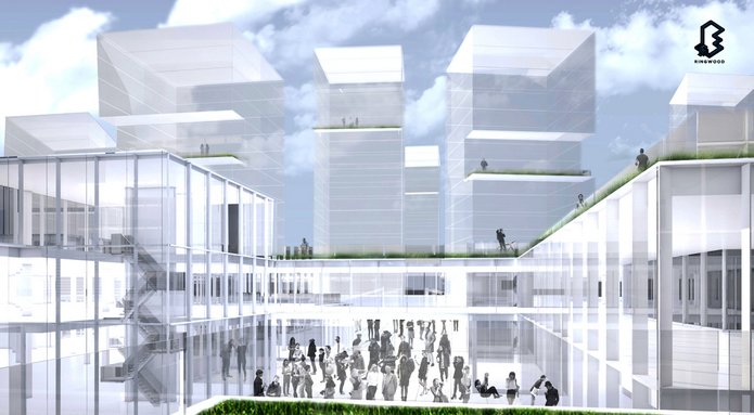
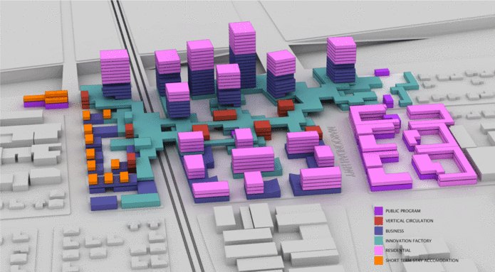
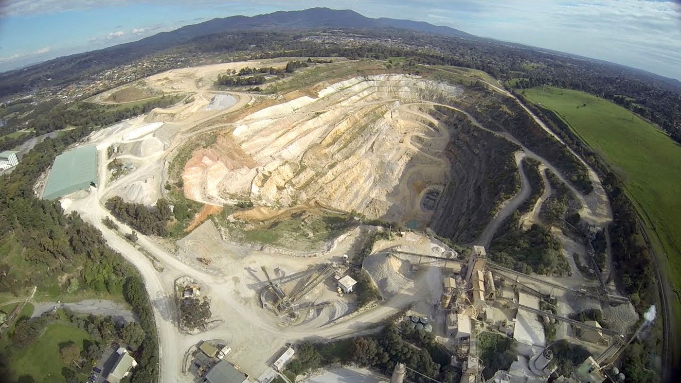
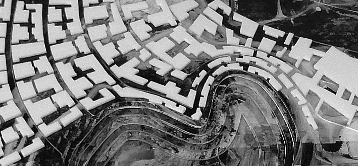
station overpasses, Box Hills linear developments, and Lilydale Quarry housing
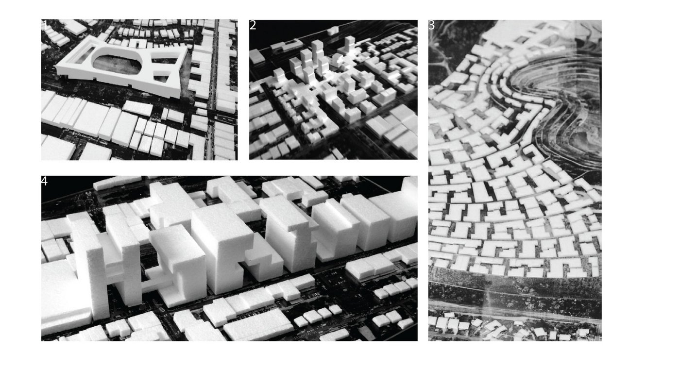
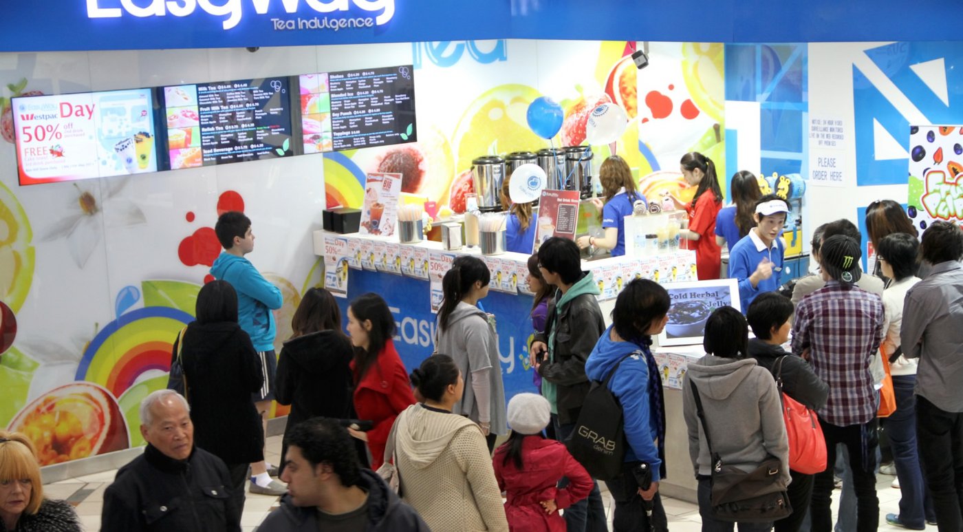
hub, for Ringwood’s production incubator, Box Hills immigration gateway, and Lilydale’s water
research centre.